
Dosya:Map Canada political 2.png

Vervênayışê ebadê: 693 × 599 piksel. Agoznayışê bini: 278 × 240 piksel | 555 × 480 piksel | 888 × 768 piksel | 1,184 × 1,024 piksel | 1,280 × 1,107 piksel.
Ebato oricinale (1,280 × 1,107 pikselan, ebatê dosya: 387 KB, MIME tipê cı: image/png)
| Na dosya depoyê Wikimedia Commons de esta u terefê proceyanê binan ra gureniyena. Cêr dê şınasiya dosyay pela mocniyeno. |
| Şınasnayış |
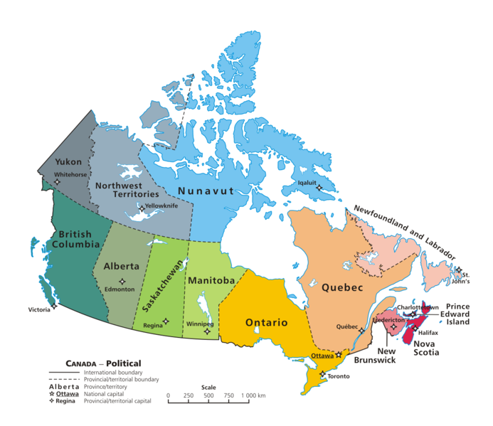
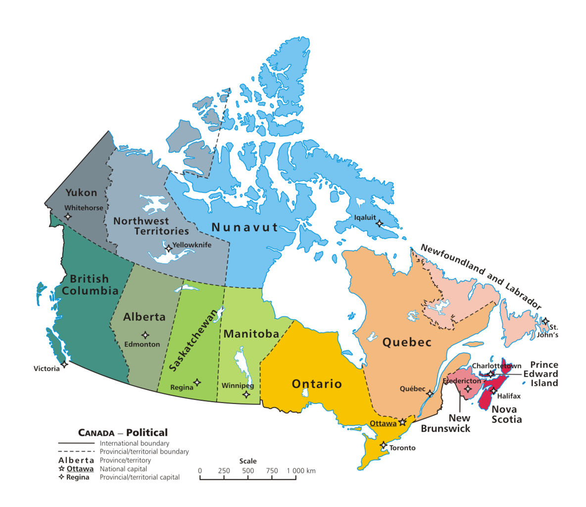
English: A map of Canada exhibiting its ten provinces and three territories, and their capitals. |
| Tarix | (UTC) |
| Çıme | |
| Nuştekar |
|
| no fotraf rotuşin biyo, fotrafi sero hebe ki vırnayış biyo. vırnayışi zi: + PNG transparency outline.orcinal fotrafo tiya de yo: Map Canada political.png. fotrafdı sazbiyayış zi GIMP kerdo.
|
Ez, ke ena dosya viraste, bine ena lisans ser cap kena:
| |
Na karkerdış heta nuskar de Example, at the [[::|English Wikipediya]] project ra biya malê şari deye hesereyaya. Dınya heme ca dı ravêrena. In case this is not legally possible: |
Qeydê barkerdışê oricinali
This image is a derivative work of the following images:
- File:Map_Canada_political.png licensed with PD-user-w
- 2007-06-13T02:50:40Z Andrew pmk 1280x1107 (250520 Bytes) optimize png
- 2007-06-06T01:38:46Z Andrew pmk 1280x1107 (250520 Bytes) optimize png
- 2006-06-06T09:35:23Z Kaveh 1280x1107 (302665 Bytes) == Summary == [[Canada]]: political map – depicting |provinces/territories and capital cities. Drawn and adapted by [[:en:User:E Pluribus Anthony|E Pluribus Anthony]] from [http://atlas.gc.ca/site/english/maps/reference/n
Uploaded with derivativeFX
Verêniya dosya
Seba diyayışê viyarteyê dosya ra tarixê ke qısımê tarix/zemani derê inan bıtıkne.
| Tarix/Zeman | Resımo qıckek | Ebadi | Karber | Mışewre | |
|---|---|---|---|---|---|
| nıkayên | 03:08, 7 Şıbat 2010 | | 1,280 - 1,107 (387 KB) | Merosonox~commonswiki | {{Information |Description={{en|1=A map of Canada exhibiting its ten provinces and three territories, and their capitals.}} |Source=*File:Map_Canada_political.png |Date=2010-02-07 03:06 (UTC) |Author=*File:Map_Canada_political.png: [[:en:User: |
Gurenayışê dosya
The following pages link to this file:
Gurenayışê dosyaya gılovere
Ena dosya wikiyanê binan de gureniyena.
- ta.wikipedia.org sero guriyayış
- tr.wikipedia.org sero guriyayış
- Kanada
- Şablon:Kanada'nın eyaletleri ve bölgeleri
- Manitoba
- Saskatchewan
- Ontario
- Kategori:Kanada'nın eyaletleri
- Prens Edward Adası
- New Brunswick
- Québec
- Alberta
- Yeni İskoçya
- Newfoundland ve Labrador
- Yukon
- Kuzeybatı Toprakları
- Nunavut
- Kanada'nın eyaletleri ve bölgeleri
- Kategori:Kanada'nın eyaletleri ve bölgeleri
- Kategori:Kanada'nın bölgeleri
- Banks Adası
- Britanya Kolumbiyası
- Saint-Maurice—Laflèche