
Dosya:Map of Ontario CHATHAM-KENT.svg

Ebadê verqaytê PNG na dosyay SVG: 340 × 330 piksel. Agoznayışê bini: 247 × 240 piksel | 495 × 480 piksel | 791 × 768 piksel | 1,055 × 1,024 piksel | 2,110 × 2,048 piksel.
Ebato oricinale (Dosyay SVGi, nominal 340 × 330 pikseli, ebadê dosya: 84 KB)
| Na dosya depoyê Wikimedia Commons de esta u terefê proceyanê binan ra gureniyena. Cêr dê şınasiya dosyay pela mocniyeno. |
Xulasa
This W3C-unspecified vector image was created with Inkscape .
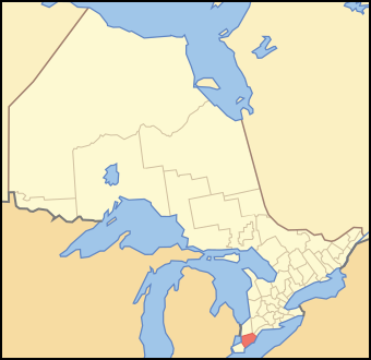
| Şınasnayış | A map of Ontario showing the location of Chatham-Kent |
| Tarix | |
| Çıme | Crop and trace of Image:Canada (geolocalisation).svg; trace of Image:Ontario subdivisions.PNG. |
| Nuştekar | Vidioman |
| Versiyonane binan | en:Image:Ontchk.PNG |
.svg)
Lisans
| Ez, Wêrê ena teliferê, nê kari Malê şarideye ezo heserena. Dınya heme ca dı ravêreno. Tay dewletan dı no kanuniyey heta mıkum nêbone; o haldı: Ez, ena karer qande herhangi yew amaci, be şert, hendı ke legali icab nikeni, şari hemi re ezo mısade dana. |
Verêniya dosya
Seba diyayışê viyarteyê dosya ra tarixê ke qısımê tarix/zemani derê inan bıtıkne.
| Tarix/Zeman | Resımo qıckek | Ebadi | Karber | Mışewre | |
|---|---|---|---|---|---|
| nıkayên | 13:37, 16 Tışrino Verên 2007 | | 340 - 330 (84 KB) | Vidioman | {{Created with Inkscape}} {{Information |Description=A map of Ontario showing the location of Chatham-Kent |Source=Crop and trace of Image:Canada (geolocalisation).svg; trace of [http://en.wikipedia.org/wiki/Image:Ontario |
.svg)
Gurenayışê dosya
The following pages link to this file:
Gurenayışê dosyaya gılovere
Ena dosya wikiyanê binan de gureniyena.
- ar.wikipedia.org sero guriyayış
- arz.wikipedia.org sero guriyayış
- ca.wikipedia.org sero guriyayış
- ceb.wikipedia.org sero guriyayış
- el.wikipedia.org sero guriyayış
- en.wikipedia.org sero guriyayış
- eo.wikipedia.org sero guriyayış
- fa.wikipedia.org sero guriyayış
- fi.wikipedia.org sero guriyayış
- it.wikipedia.org sero guriyayış
- ja.wikipedia.org sero guriyayış
- pl.wikipedia.org sero guriyayış
- sv.wikipedia.org sero guriyayış
- uk.wikipedia.org sero guriyayış
- ur.wikipedia.org sero guriyayış
- vo.wikipedia.org sero guriyayış
- www.wikidata.org sero guriyayış
- zh.wikipedia.org sero guriyayış