
Dosya:Relief Map of Brazil.jpg

Vervênayışê ebadê: 607 × 600 piksel. Agoznayışê bini: 243 × 240 piksel | 486 × 480 piksel | 777 × 768 piksel | 1,200 × 1,186 piksel.
Ebato oricinale (1,200 × 1,186 pikselan, ebatê dosya: 1.05 MB, MIME tipê cı: image/jpeg)
| Na dosya depoyê Wikimedia Commons de esta u terefê proceyanê binan ra gureniyena. Cêr dê şınasiya dosyay pela mocniyeno. |
| Şınasnayış |
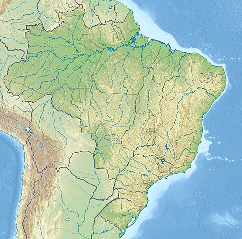
English: Location map of Brazil Equirectangular projection, N/S stretching 105 %. Geographic limits of the map:
|
|||
| Tarix | (UTC) | |||
| Çıme |
|
|||
| Nuştekar |
|
|||
| Versiyonane binan |
|


| no fotraf rotuşin biyo, fotrafi sero hebe ki vırnayış biyo. orcinal fotrafo tiya de yo: Brazil location map.svg.
|
Ez, ke ena dosya viraste, bine ena lisans ser cap kena:
Ena dosya binê Creative Commons Attribution-Share Alike 3.0 Unported lisans biya.
- Nê weçenegan dê xoseri:
- bare kerdene – qe gure kopya kerdişi, vila kerdişi u şawitişi
- qe reyna mix kerdişi – qe kabul kerdişi gure
- bine enê şarti:
- gıredayış – Lazımo ke şıma icazet bıdê, lisansi rê link, vuriyayış ke biyo belû kerê. Ney şıma usulên ra şenê bıkerê, labelê karkerdış u iştirakê şıma terefê wayirê lisansi ra zey qebulbiyene yew qeyde çıniyo.
- sey yewbini barekerdış – Meqaleyi ke reyna têv dê, tadê ya zi fına inşa bıkerê, iştırakê şıma lazımo ke zey orcinali same or compatible license bın de vıla kerê.
Qeydê barkerdışê oricinali
This image is a derivative work of the following images:
- File:Brazil_location_map.svg licensed with Cc-by-sa-3.0
- 2009-08-05T19:53:55Z NordNordWest 2008x1984 (1674058 Bytes) {{int:filedesc}} {{Information |Description= {{de|Positionskarte von [[:de:Brasilien|Brasilien]]}} Quadratische Plattkarte, N-S-Streckung 105 %. Geographische Begrenzung der Karte: * N: 6.0° N * S: 34.0° S * W: 74.5° W * O
Uploaded with derivativeFX
Verêniya dosya
Seba diyayışê viyarteyê dosya ra tarixê ke qısımê tarix/zemani derê inan bıtıkne.
| Tarix/Zeman | Resımo qıckek | Ebadi | Karber | Mışewre | |
|---|---|---|---|---|---|
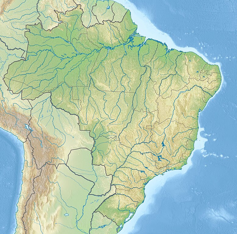
| nıkayên | 21:46, 14 Gulane 2017 | | 1,200 - 1,186 (1.05 MB) | Janitoalevic | Added Rincón de Artigas disputed territory |
| 17:55, 27 Tışrino Peyên 2010 |  | 1,200 - 1,186 (492 KB) | Виктор В | {{Information |Description={{en|Location map of Brazil}} Equirectangular projection, N/S stretching 105 %. Geographic limits of the map: * N: 6.0° N * S: 34.0° S * W: 74.5° W * E: 32.0° W |Source=*File:Brazil_location_map.svg |
Gurenayışê dosya
The following pages link to this file:
Gurenayışê dosyaya gılovere
Ena dosya wikiyanê binan de gureniyena.
- an.wikipedia.org sero guriyayış
- ar.wikipedia.org sero guriyayış
- ban.wikipedia.org sero guriyayış
- bg.wikipedia.org sero guriyayış
- Рио де Жанейро
- Итайпу
- Порто Алегри
- Сао Пауло
- Ирара
- Бауру
- Маже
- Айморес (Минаш Жерайс)
- Мост на дружбата (Парагвай - Бразилия)
- Бразилия (град)
- Петрополис
- Ресифи
- Флорианополис
- Анаполис
- Мадейра (река)
- Токантинс (река)
- Рио Негро (приток на Амазонка)
- Манаус
- Такуари
- Салвадор (Баия)
- Сантос
- Сао Бернардо до Кампо
- Розейра
- Ипатинга
- Трес Корасойнс
- Паулиста (Пернамбуко)
- Сао Висенти (Сао Пауло)
- Прадополис
- Белен (Пара)
- Бело Оризонти
- Масейо
- Форталеза
- Витория (Еспирито Санто)
- Гояния
- Кампо Гранди
- Кашоейра до Сул
- Итабуна
- Куритиба
- Арара (Параиба)
Yê na dosya gurenayışê gıloveri tayêna bıvêne.