
Dosya:Nouvelle-Calédonie collectivity location map.svg

Ebadê verqaytê PNG na dosyay SVG: 800 × 295 piksel. Agoznayışê bini: 320 × 118 piksel | 640 × 236 piksel | 1,024 × 377 piksel | 1,280 × 471 piksel | 2,560 × 942 piksel | 1,608 × 592 piksel.
Ebato oricinale (Dosyay SVGi, nominal 1,608 × 592 pikseli, ebadê dosya: 207 KB)
| Na dosya depoyê Wikimedia Commons de esta u terefê proceyanê binan ra gureniyena. Cêr dê şınasiya dosyay pela mocniyeno. |
Xulasa
| Camera location | | View this and other nearby images on: OpenStreetMap |
|---|
| Şınasnayış |
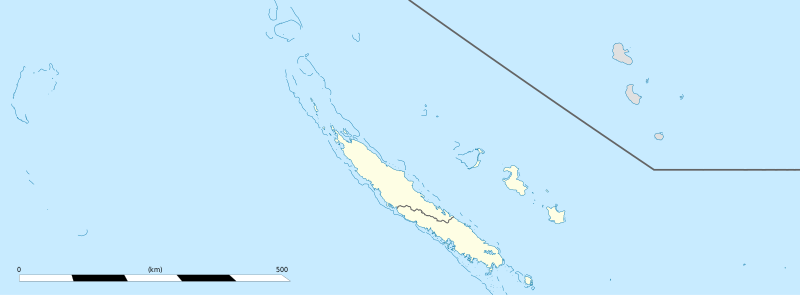
English: Blank administrative map of the territorial collectivity of New Caledonia, France, for geo-location purpose.
This is a general map allowing to geo-locate remote islands. For maps centered on the main islands, see below. Français : Carte administrative vierge de la collectivité territoriale de Nouvelle-Calédonie, France, destinée à la géolocalisation. Ceci est une carte générale permettant la géolocalisation des îles isolées. Pour des cartes centrées sur les îles principales, voir plus bas. Equirectangular projection, WGS84 datum
Geographic limits of the map:
|
||
| Tarix | |||
| Çıme |
Karo şexsi
|
||
| Nuştekar | Eric Gaba (Sting - fr:Sting) | ||
| Destur (Reyna sixulnayise ena dosya) |
|
||
| Versiyonane binan |
|


Lisans
Ez, ke ena dosya viraste, bine ena lisansan ser cap kena:
Ena dosya binê Creative Commons Attribution-Share Alike 3.0 Unported lisans biya.
- Nê weçenegan dê xoseri:
- bare kerdene – qe gure kopya kerdişi, vila kerdişi u şawitişi
- qe reyna mix kerdişi – qe kabul kerdişi gure
- bine enê şarti:
- gıredayış – Lazımo ke şıma icazet bıdê, lisansi rê link, vuriyayış ke biyo belû kerê. Ney şıma usulên ra şenê bıkerê, labelê karkerdış u iştirakê şıma terefê wayirê lisansi ra zey qebulbiyene yew qeyde çıniyo.
- sey yewbini barekerdış – Meqaleyi ke reyna têv dê, tadê ya zi fına inşa bıkerê, iştırakê şıma lazımo ke zey orcinali same or compatible license bın de vıla kerê.

|
Şıma şenê ena dosya kopya kerê, vıla kerê ya zi bıvırnê bınê GNU Free Documentation License, Versiyon 1.2 ya zi versiyonane ke cap biye pê Free Software Foundation; pê nê Invariant Sections, nê Front-Cover Texts u nê Back-Cover Texts. You qısımê kopya bine GNU Free Documentation License estê. |
Ti eskena lisanse xo biwecini.
Verêniya dosya
Seba diyayışê viyarteyê dosya ra tarixê ke qısımê tarix/zemani derê inan bıtıkne.
| Tarix/Zeman | Resımo qıckek | Ebadi | Karber | Mışewre | |
|---|---|---|---|---|---|
| nıkayên | 15:26, 4 Tebaxe 2013 | 1,608 - 592 (207 KB) | Szczureq | removed non-existent Sandy Island | |
| 03:07, 21 Çele 2009 | 1,608 - 592 (177 KB) | Sting | == Summary == {{Location|20|22|30|S|165|10|30|E|scale:5000000}} <br/> {{Information |Description={{en|Blank administrative map of the territorial collectivity of New Caledonia, France, for |
Gurenayışê dosya
There are no pages that link to this file.
Gurenayışê dosyaya gılovere
Ena dosya wikiyanê binan de gureniyena.
- ba.wikipedia.org sero guriyayış
- bn.wikipedia.org sero guriyayış
- de.wikipedia.org sero guriyayış
- fr.wikipedia.org sero guriyayış
- Aquarium des lagons
- Îles Chesterfield
- Province Nord (Nouvelle-Calédonie)
- Grande Terre (Nouvelle-Calédonie)
- Nouvelle-Calédonie
- Centre culturel Tjibaou
- Communauté du Pacifique
- Aéroport international de Nouméa-La Tontouta
- Province Sud (Nouvelle-Calédonie)
- Aéroport de Magenta
- Place des Cocotiers
- Géographie de la Nouvelle-Calédonie
- Fayaoué
- Prise d'otages d'Ouvéa
- Hippodrome Henri-Milliard
- Lekine
- Île Hunter (Pacifique Sud)
- Île Matthew
- Île Walpole (Nouvelle-Calédonie)
- Hôpital Gaston-Bourret
- Hôpital de Magenta
- Centre hospitalier territorial Gaston-Bourret de Nouvelle-Calédonie
- Centre hospitalier spécialisé Albert-Bousquet
- Polyclinique de l'Anse Vata
- Clinique Magnin
- Clinique de la Baie des Citrons
- Modèle:Infobox Tribu de Nouvelle-Calédonie
- Barrage de Yaté
- Cœur de Voh
- Expédition d'Entrecasteaux
- Université de la Nouvelle-Calédonie
- Fort Teremba
- Parc zoologique et forestier Michel-Corbasson
- Foire de Bourail
- Plage de Poé
- Modèle:Géolocalisation/Nouvelle-Calédonie
- Stade Numa-Daly
- Wikipédia:Atelier graphique/Cartes/Archives/Demandes mises en sommeil
- Récifs d'Entrecasteaux
- Gossanah
Yê na dosya gurenayışê gıloveri tayêna bıvêne.