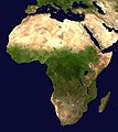
Dosya:Africa satellite orthographic.jpg

Vervênayışê ebadê: 534 × 600 piksel. Agoznayışê bini: 214 × 240 piksel | 427 × 480 piksel | 684 × 768 piksel | 912 × 1,024 piksel | 1,624 × 1,824 piksel.
Ebato oricinale (1,624 × 1,824 pikselan, ebatê dosya: 535 KB, MIME tipê cı: image/jpeg)
Verêniya dosya
Seba diyayışê viyarteyê dosya ra tarixê ke qısımê tarix/zemani derê inan bıtıkne.
| Tarix/Zeman | Resımo qıckek | Ebadi | Karber | Mışewre | |
|---|---|---|---|---|---|
| nıkayên | 09:44, 19 Nisane 2005 |  | 1,624 - 1,824 (535 KB) | Ghalas | A composed satellite photograph of Africa in orthographic projection This is NASA [http://visibleearth.nasa.gov/view_rec.php?vev1id=11656 "Blue Marble"] image applied as a texture on a sphere u |
Gurenayışê dosya
The following pages link to this file:
Gurenayışê dosyaya gılovere
Ena dosya wikiyanê binan de gureniyena.
- af.wikipedia.org sero guriyayış
- ang.wikipedia.org sero guriyayış
- ar.wikipedia.org sero guriyayış
- ar.wikinews.org sero guriyayış
- ary.wikipedia.org sero guriyayış
- arz.wikipedia.org sero guriyayış
- ast.wikipedia.org sero guriyayış
- as.wikipedia.org sero guriyayış
- awa.wikipedia.org sero guriyayış
- az.wikipedia.org sero guriyayış
- bat-smg.wikipedia.org sero guriyayış
- ba.wikipedia.org sero guriyayış
- be-tarask.wikipedia.org sero guriyayış
- be.wikipedia.org sero guriyayış
- bg.wikipedia.org sero guriyayış
Yê na dosya gurenayışê gıloveri tayêna bıvêne.


