
Dosya:Ankara asv2021-10 img04 Anıtkabir.jpg
Vervênayışê ebadê: 800 × 400 piksel. Agoznayışê bini: 320 × 160 piksel | 640 × 320 piksel | 1,024 × 512 piksel | 1,280 × 640 piksel | 2,560 × 1,280 piksel | 7,594 × 3,797 piksel.
Ebato oricinale (7,594 × 3,797 pikselan, ebatê dosya: 12.18 MB, MIME tipê cı: image/jpeg)
| Na dosya depoyê Wikimedia Commons de esta u terefê proceyanê binan ra gureniyena. Cêr dê şınasiya dosyay pela mocniyeno. |
Xulasa
| Şınasnayış |
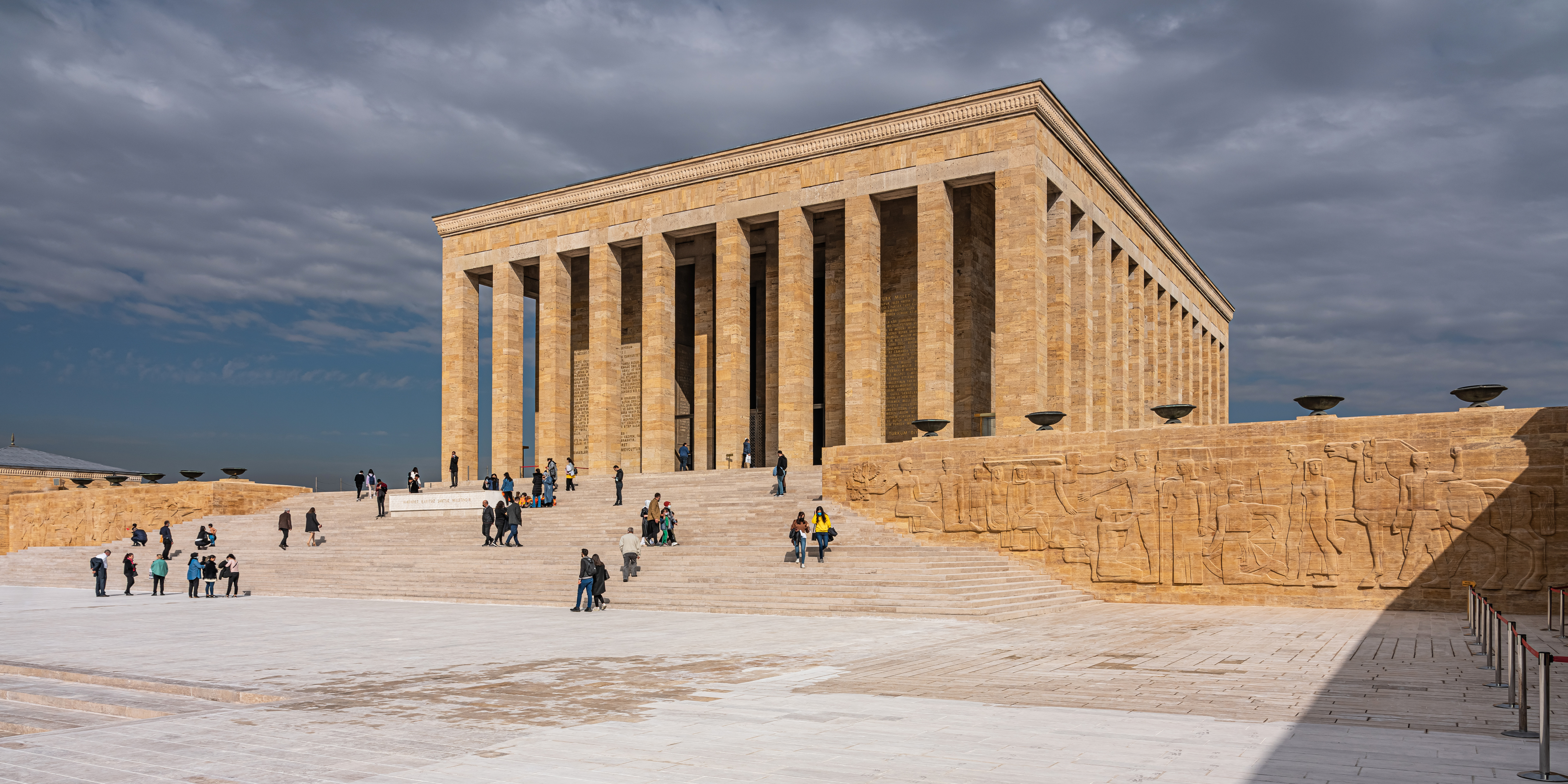
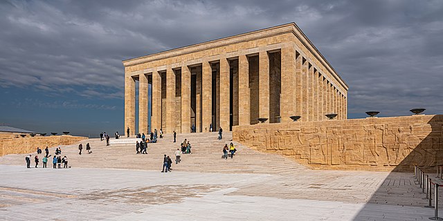
English: Anıtkabir (the mausoleum with Atatürk's tomb) in Ankara, Turkey
Русский: Аныткабир (мавзолей с усыпальницей Ататюрка) в Анкаре, Турция |
||
| Tarix | |||
| Çıme | Karo şexsi | ||
| Nuştekar | A.Savin | ||
| Destur (Reyna sixulnayise ena dosya) |
.svg) Just attribute the author: «A.Savin, Wikipedia»; if you have questions — Telegram, or e-mail to wikiphotospace@gmail.com..svg) Просто укажите в качестве автора: «А.Савин, Википедия»; если есть вопрос — телеграм, или эл.почта на wikiphotospace@gmail.com. Kennzeichnen Sie einfach als Autor: «A.Savin, Wikipedia»; falls Sie Fragen haben — Telegram, oder E-Mail an wikiphotospace@gmail.com.
Thank you.
|
| Camera location | | View this and other nearby images on: OpenStreetMap |
|---|
Lisans
| Copyleft: Ena dosya bedeva ya; ti eşkena ena dosya vila bike ya zi vurne bine Free Art License. Ti eskena sartanê lisansê itiya de Copyleft Attitude site u siteyane binan de bivine. |
Verêniya dosya
Seba diyayışê viyarteyê dosya ra tarixê ke qısımê tarix/zemani derê inan bıtıkne.
| Tarix/Zeman | Resımo qıckek | Ebadi | Karber | Mışewre | |
|---|---|---|---|---|---|
| nıkayên | 05:38, 1 Şıbat 2022 | | 7,594 - 3,797 (12.18 MB) | A.Savin | {{User:A.Savin/F|L=1 |Description= {{en|Anıtkabir (the mausoleum with Atatürk's tomb) in Ankara, Turkey}} {{ru|Аныткабир (мавзолей с усыпальницей Ататюрка) в Анкаре, Турция}} |Year=2021 |Country=Turkey |Month=10 |Day=27}} {{Location}} Category:Taken with Sony ILCE-7RM3 Category:Taken with Sony FE 24-105mm F4 G OSS Category:2021 in Ankara Category:Exterior of Anıtkabir Category:Reliefs in Anıtkabir Category:Stairs in Ankara Category:Clouds and blue sky in Turkey |
Gurenayışê dosya
The following pages link to this file:
Gurenayışê dosyaya gılovere
Ena dosya wikiyanê binan de gureniyena.
- ar.wikipedia.org sero guriyayış
- arz.wikipedia.org sero guriyayış
- az.wikipedia.org sero guriyayış
- ba.wikipedia.org sero guriyayış
- be.wikipedia.org sero guriyayış
- bg.wikipedia.org sero guriyayış
- bn.wikipedia.org sero guriyayış
- cs.wikipedia.org sero guriyayış
- de.wikipedia.org sero guriyayış
- de.wikivoyage.org sero guriyayış
- el.wikipedia.org sero guriyayış
- en.wikipedia.org sero guriyayış
- en.wikivoyage.org sero guriyayış
- en.wiktionary.org sero guriyayış
- eo.wikipedia.org sero guriyayış
- es.wikipedia.org sero guriyayış
- et.wikipedia.org sero guriyayış
- eu.wikipedia.org sero guriyayış
- fa.wikipedia.org sero guriyayış
- fi.wikipedia.org sero guriyayış
- fr.wikipedia.org sero guriyayış
- he.wikipedia.org sero guriyayış
- hu.wikipedia.org sero guriyayış
- hy.wikipedia.org sero guriyayış
- it.wikipedia.org sero guriyayış
- ja.wikipedia.org sero guriyayış
Yê na dosya gurenayışê gıloveri tayêna bıvêne.