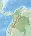
Dosya:Colombia relief location map.jpg

Vervênayışê ebadê: 530 × 600 piksel. Agoznayışê bini: 212 × 240 piksel | 424 × 480 piksel | 679 × 768 piksel | 905 × 1,024 piksel | 2,028 × 2,294 piksel.
Ebato oricinale (2,028 × 2,294 pikselan, ebatê dosya: 1.1 MB, MIME tipê cı: image/jpeg)
Verêniya dosya
Seba diyayışê viyarteyê dosya ra tarixê ke qısımê tarix/zemani derê inan bıtıkne.
| Tarix/Zeman | Resımo qıckek | Ebadi | Karber | Mışewre | |
|---|---|---|---|---|---|
| nıkayên | 06:53, 16 Şıbat 2015 |  | 2,028 - 2,294 (1.1 MB) | Milenioscuro | same dimensions of locator map.svg |
| 12:38, 6 Şıbat 2010 |  | 1,516 - 1,736 (901 KB) | Alexrk2 | {{Information |Description= {{de|Physische Positionskarte von Kolumbien Quadratische Plattkarte. Geographische Begrenzung der Karte:}} {{en|Physical Location map of Colombia Equirectangular projection. Geographic limits |
Gurenayışê dosya
The following pages link to this file:
Gurenayışê dosyaya gılovere
Ena dosya wikiyanê binan de gureniyena.
- als.wikipedia.org sero guriyayış
- ar.wikipedia.org sero guriyayış
- ast.wikipedia.org sero guriyayış
- avk.wikipedia.org sero guriyayış
- azb.wikipedia.org sero guriyayış
- az.wikipedia.org sero guriyayış
- ban.wikipedia.org sero guriyayış
- ba.wikipedia.org sero guriyayış
- be.wikipedia.org sero guriyayış
- bg.wikipedia.org sero guriyayış
Yê na dosya gurenayışê gıloveri tayêna bıvêne.


