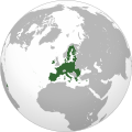
Dosya:Global European Union.svg

Ebadê verqaytê PNG na dosyay SVG: 600 × 600 piksel. Agoznayışê bini: 240 × 240 piksel | 480 × 480 piksel | 768 × 768 piksel | 1,024 × 1,024 piksel | 2,048 × 2,048 piksel | 792 × 792 piksel.
Ebato oricinale (Dosyay SVGi, nominal 792 × 792 pikseli, ebadê dosya: 5.58 MB)
Verêniya dosya
Seba diyayışê viyarteyê dosya ra tarixê ke qısımê tarix/zemani derê inan bıtıkne.
| Tarix/Zeman | Resımo qıckek | Ebadi | Karber | Mışewre | |
|---|---|---|---|---|---|
| nıkayên | 19:39, 7 Temuze 2021 |  | 792 - 792 (5.58 MB) | AmeSavoia | Reverted to version as of 10:23, 22 November 2020 (UTC) |
| 19:38, 7 Temuze 2021 |  | 792 - 792 (5.46 MB) | AmeSavoia | Reverted to version as of 18:43, 29 March 2017 (UTC) | |
| 10:23, 22 Tışrino Peyên 2020 |  | 792 - 792 (5.58 MB) | M.Bitton | Reverted to version as of 11:34, 5 February 2020 (UTC) | |
| 04:32, 22 Tışrino Peyên 2020 |  | 792 - 792 (5.46 MB) | Taha Khattabi | Reverted to version as of 00:06, 1 February 2020 (UTC) | |
| 11:34, 5 Şıbat 2020 |  | 792 - 792 (5.58 MB) | Rob984 | Per UN maps, changed Golan Heights border and removed Western Sahara de facto border (berm). Neither of these disputes are relevant to the European Union unlike Kosovo. Discussion at W:Talk:European Union#The new map, where there wasn't consensus for dotted borders. | |
| 09:10, 2 Şıbat 2020 |  | 792 - 792 (5.52 MB) | Rob984 | Fixed Flevoland in the Netherlands and general code cleanup (removing redundant groups etc.) | |
| 01:29, 1 Şıbat 2020 |  | 792 - 792 (5.5 MB) | Rob984 | Reverted to version as of 01:37, 16 September 2018 (UTC) and redone change to UK as well as Gibraltar. Fixed gradient and other issues. Restored Western Sahara-Morocco border which was removed on 1 April 2018. | |
| 00:42, 1 Şıbat 2020 |  | 792 - 792 (2.88 MB) | M.Bitton | Reverted to version as of 23:01, 31 January 2020 (UTC): This version shows the wrong map for Western Sahara. The border between it and Morocco needs to be visible | |
| 00:06, 1 Şıbat 2020 |  | 792 - 792 (5.46 MB) | Rob984 | Reverted to version as of 01:37, 16 September 2018 (UTC) and redone change to UK as well as Gibraltar. Fixed gradient and other issues. | |
| 23:01, 31 Çele 2020 |  | 792 - 792 (2.88 MB) | Simtropolitan | Reverted to version as of 13:22, 31 January 2020 (UTC); Brexit |
Gurenayışê dosya
The following pages link to this file:
Gurenayışê dosyaya gılovere
Ena dosya wikiyanê binan de gureniyena.
- ady.wikipedia.org sero guriyayış
- af.wikipedia.org sero guriyayış
- an.wikipedia.org sero guriyayış
- arc.wikipedia.org sero guriyayış
- ar.wikipedia.org sero guriyayış
- ar.wikibooks.org sero guriyayış
- ar.wikinews.org sero guriyayış
- ast.wikipedia.org sero guriyayış
- as.wikipedia.org sero guriyayış
- avk.wikipedia.org sero guriyayış
- ba.wikipedia.org sero guriyayış
- be-tarask.wikipedia.org sero guriyayış
- bh.wikipedia.org sero guriyayış
- bn.wikipedia.org sero guriyayış
- bxr.wikipedia.org sero guriyayış
- cdo.wikipedia.org sero guriyayış
- cy.wikipedia.org sero guriyayış
- da.wikipedia.org sero guriyayış
- Den Europæiske Union
- Wikipedia:Dagens skandinaviske artikel/april 2009
- Wikipedia:Dagens skandinaviske artikel/Søndag/Uge 14, 2009
- Skabelon:Infoboks land
- Skabelon:Infoboks land/doc
- Skabelon:Infoboks land/sandkasse
- Skabelon:Collapsible list/testcases
- Bruger:NisJørgensen/sandkasse/Skabelon:Infoboks land/doc
- Bruger:NisJørgensen/sandkasse/Skabelon:Infoboks land
- de.wikipedia.org sero guriyayış
- dty.wikipedia.org sero guriyayış
- el.wikipedia.org sero guriyayış
- en.wikipedia.org sero guriyayış
- Geography of the European Union
- User talk:Ithinkhelikesit
- User talk:Aesopos
- User talk:Montessquieu
- User talk:Gpeilon
- User talk:Robster1983
- User talk:Waterfall999
- Template:European Union project welcome
- List of regional organizations by population
- User talk:Boson/Archive 1
- User talk:Imperium Europeum
- User talk:Höchtsgeschwindigkeit
- User talk:Philrock
- User talk:BadYodels
- User talk:Louis Du Pasquier
- Template:European Union project welcome inner
- User talk:Andrzej Kmicic
- User talk:Darwinek/Archive3
Yê na dosya gurenayışê gıloveri tayêna bıvêne.


