
Dosya:Greater London UK locator map 2010.svg

Ebadê verqaytê PNG na dosyay SVG: 494 × 600 piksel. Agoznayışê bini: 198 × 240 piksel | 395 × 480 piksel | 633 × 768 piksel | 843 × 1,024 piksel | 1,687 × 2,048 piksel | 1,108 × 1,345 piksel.
Ebato oricinale (Dosyay SVGi, nominal 1,108 × 1,345 pikseli, ebadê dosya: 302 KB)
| Na dosya depoyê Wikimedia Commons de esta u terefê proceyanê binan ra gureniyena. Cêr dê şınasiya dosyay pela mocniyeno. |
Xulasa
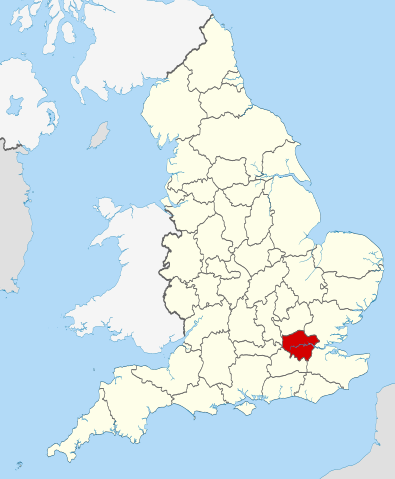
| Şınasnayış | Location of the ceremonial county of Greater London within England. |
| Tarix | |
| Çıme |
National Geospatial-Intelligence Agency
|
| Nuştekar | Nilfanion |
Lisans
Ez, ke ena dosya viraste, bine ena lisansan ser cap kena:
Ena dosya binê Creative Commons Attribution-Share Alike 3.0 Unported lisans biya.
- Nê weçenegan dê xoseri:
- bare kerdene – qe gure kopya kerdişi, vila kerdişi u şawitişi
- qe reyna mix kerdişi – qe kabul kerdişi gure
- bine enê şarti:
- gıredayış – Lazımo ke şıma icazet bıdê, lisansi rê link, vuriyayış ke biyo belû kerê. Ney şıma usulên ra şenê bıkerê, labelê karkerdış u iştirakê şıma terefê wayirê lisansi ra zey qebulbiyene yew qeyde çıniyo.
- sey yewbini barekerdış – Meqaleyi ke reyna têv dê, tadê ya zi fına inşa bıkerê, iştırakê şıma lazımo ke zey orcinali same or compatible license bın de vıla kerê.

|
Şıma şenê ena dosya kopya kerê, vıla kerê ya zi bıvırnê bınê GNU Free Documentation License, Versiyon 1.2 ya zi versiyonane ke cap biye pê Free Software Foundation; pê nê Invariant Sections, nê Front-Cover Texts u nê Back-Cover Texts. You qısımê kopya bine GNU Free Documentation License estê. |
Ti eskena lisanse xo biwecini.

|
This is one of the images forming part of the Valued image set: Locator maps of the Ceremonial counties of England on Wikimedia Commons. The image set has been assessed under the valued image set criteria and is considered the most valued set on Commons within the scope:
Locator maps of the Ceremonial counties of England
You can see its nomination at Commons:Valued image candidates/Locator maps of English ceremonial counties. |
Verêniya dosya
Seba diyayışê viyarteyê dosya ra tarixê ke qısımê tarix/zemani derê inan bıtıkne.
| Tarix/Zeman | Resımo qıckek | Ebadi | Karber | Mışewre | |
|---|---|---|---|---|---|
| nıkayên | 22:36, 23 Tışrino Peyên 2010 | | 1,108 - 1,345 (302 KB) | Nilfanion | == Summary == {{Information |Description=Location of the ceremonial county of Greater London within England. |Source=Ordnance Survey [https://www.ordnancesurvey.co.uk/opendatadownload/products.html OpenData]: *Co |
Gurenayışê dosya
The following pages link to this file:
Gurenayışê dosyaya gılovere
Ena dosya wikiyanê binan de gureniyena.
- af.wikipedia.org sero guriyayış
- ar.wikipedia.org sero guriyayış
- arz.wikipedia.org sero guriyayış
- ast.wikipedia.org sero guriyayış
- az.wikipedia.org sero guriyayış
- be-tarask.wikipedia.org sero guriyayış
- br.wikipedia.org sero guriyayış
- ca.wikipedia.org sero guriyayış
- de.wikipedia.org sero guriyayış
- el.wikipedia.org sero guriyayış
- en.wikipedia.org sero guriyayış
- es.wikipedia.org sero guriyayış
- fa.wikipedia.org sero guriyayış
- fi.wikipedia.org sero guriyayış
- fr.wikipedia.org sero guriyayış
- fr.wiktionary.org sero guriyayış
- fur.wikipedia.org sero guriyayış
- ga.wikipedia.org sero guriyayış
- gl.wikipedia.org sero guriyayış
- hak.wikipedia.org sero guriyayış
- id.wikipedia.org sero guriyayış
- it.wikipedia.org sero guriyayış
- ja.wikipedia.org sero guriyayış
- la.wikipedia.org sero guriyayış
- lij.wikipedia.org sero guriyayış
- lld.wikipedia.org sero guriyayış
- lt.wikipedia.org sero guriyayış
- mr.wikipedia.org sero guriyayış
- ms.wikipedia.org sero guriyayış
- nl.wikipedia.org sero guriyayış
- oc.wikipedia.org sero guriyayış
- os.wikipedia.org sero guriyayış
- pl.wikipedia.org sero guriyayış
- pl.wiktionary.org sero guriyayış
- roa-tara.wikipedia.org sero guriyayış
- ru.wikinews.org sero guriyayış
- Самым женским автомобилем 2009 года стал автомобиль люксовой марки Jaguar
- Беспорядки в Тоттенхэме привели к пожару
- Шаблон:Лондон
- Беспорядки из Тоттенхэма распространились по всему Лондону
- Из-за беспорядков в Лондоне отменяются спортивные мероприятия
- Лужков не желает позволять Кремлю вытирать о себя ноги
- В Лондоне арестован сын бывшего президента Киргизии
- Королеву Великобритании Елизавету II госпитализировали
- В Лондоне началась вторая в году забастовка сотрудников метрополитена
Yê na dosya gurenayışê gıloveri tayêna bıvêne.