
Dosya:Guernsey from the air - geograph.ci - 371.jpg
Deha berz agozney cı çıniyo
Guernsey_from_the_air_-_geograph.ci_-_371.jpg (640 × 412 pikselan, ebatê dosya: 203 KB, MIME tipê cı: image/jpeg)
| Na dosya depoyê Wikimedia Commons de esta u terefê proceyanê binan ra gureniyena. Cêr dê şınasiya dosyay pela mocniyeno. |
| Şınasnayış |
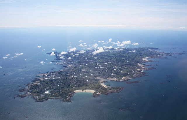
Guernsey from the air. Viewed from a flight from Gloucester to Jersey. |
| Tarix | |
| Çıme | From channel-islands.geographs.org; transferred by User:oxyman using geograph_org2commons. |
| Nuştekar | Bob Embleton |
| Destur (Reyna sixulnayise ena dosya) |
Creative Commons Attribution Share-alike license 2.0 |
| Camera location | | View this and other nearby images on: OpenStreetMap |
|---|

|
This image was taken from the Geograph Channel Islands collection. See this photograph's page on the Geograph website for the photographer's contact details. The copyright on this image is owned by Bob Embleton and is licensed for reuse under the Creative Commons Attribution-ShareAlike 2.0 license.
|
Ena dosya binê Creative Commons Attribution-Share Alike 2.0 Generic lisans biya.
Gırêdayış: Bob Embleton
- Nê weçenegan dê xoseri:
- bare kerdene – qe gure kopya kerdişi, vila kerdişi u şawitişi
- qe reyna mix kerdişi – qe kabul kerdişi gure
- bine enê şarti:
- gıredayış – Lazımo ke şıma icazet bıdê, lisansi rê link, vuriyayış ke biyo belû kerê. Ney şıma usulên ra şenê bıkerê, labelê karkerdış u iştirakê şıma terefê wayirê lisansi ra zey qebulbiyene yew qeyde çıniyo.
- sey yewbini barekerdış – Meqaleyi ke reyna têv dê, tadê ya zi fına inşa bıkerê, iştırakê şıma lazımo ke zey orcinali same or compatible license bın de vıla kerê.
Verêniya dosya
Seba diyayışê viyarteyê dosya ra tarixê ke qısımê tarix/zemani derê inan bıtıkne.
| Tarix/Zeman | Resımo qıckek | Ebadi | Karber | Mışewre | |
|---|---|---|---|---|---|
| nıkayên | 16:53, 23 Gulane 2010 | | 640 - 412 (203 KB) | File Upload Bot (Magnus Manske) | {{Information |Description=Guernsey from the air. Viewed from a flight from Gloucester to Jersey.<br /> Here we are looking at the sandy bay on the north coast of the island by the Royal Guernsey Golf Club. |Source=From [http://channel-islands.geographs.o |
Gurenayışê dosya
The following pages link to this file:
Gurenayışê dosyaya gılovere
Ena dosya wikiyanê binan de gureniyena.
- arz.wikipedia.org sero guriyayış
- ast.wikipedia.org sero guriyayış
- ca.wikipedia.org sero guriyayış
- cy.wikipedia.org sero guriyayış
- de.wikipedia.org sero guriyayış
- de.wikivoyage.org sero guriyayış
- en.wikipedia.org sero guriyayış
- en.wikibooks.org sero guriyayış
- eo.wikipedia.org sero guriyayış
- es.wikipedia.org sero guriyayış
- fi.wikipedia.org sero guriyayış
- frp.wikipedia.org sero guriyayış
- fr.wikipedia.org sero guriyayış
- fr.wikivoyage.org sero guriyayış
- ga.wikipedia.org sero guriyayış
- gd.wikipedia.org sero guriyayış
- gl.wikipedia.org sero guriyayış
- ha.wikipedia.org sero guriyayış
- hu.wikipedia.org sero guriyayış
- mt.wikipedia.org sero guriyayış
- pcd.wikipedia.org sero guriyayış
- ru.wikipedia.org sero guriyayış
- ru.wikinews.org sero guriyayış
- sr.wikipedia.org sero guriyayış
- vi.wikipedia.org sero guriyayış
- www.wikidata.org sero guriyayış