
Dosya:Japan location map with side map of the Ryukyu Islands.svg

Ebato oricinale (Dosyay SVGi, nominal 413 × 373 pikseli, ebadê dosya: 980 KB)
| Na dosya depoyê Wikimedia Commons de esta u terefê proceyanê binan ra gureniyena. Cêr dê şınasiya dosyay pela mocniyeno. |
Xulasa
| Şınasnayış |
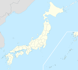
Deutsch: Postionskarte von Japan
Quadratische Plattkarte. Bei Nutzung der Hauptkarte mit den Hauptinseln gelten folgende geographische Begrenzungen für die (Gesamt-)Karte:
Bei Nutzung der Nebenkarte mit den Ryūkyū-Inseln gelten folgende geographische Begrenzungen für die (Gesamt-)Karte:
English: Location map of Japan
Equirectangular projection. Geographic limits to locate objects in the main map with the main islands:
Geographic limits to locate objects in the side map with the Ryukyu Islands:
日本語: 日本国の地図。
正距円筒図法。 南西諸島以外の日本を描いたメインの地図が示す領域:
南西諸島を描いた右下の地図が示す領域:
|
||
| Tarix | |||
| Çıme | Karo şexsi | ||
| Nuştekar | Maximilian Dörrbecker (Chumwa) | ||
| Destur (Reyna sixulnayise ena dosya) |
Ez, ke ena dosya viraste, bine ena lisansan ser cap kena:
Ena dosya binê Creative Commons Attribution-Share Alike 3.0 Unported lisans biya.
Ti eskena lisanse xo biwecini. |
||
| Versiyonane binan |
Derivative works of this file: |
||
| SVG genesis | This map was created with Adobe Illustrator.
|


Verêniya dosya
Seba diyayışê viyarteyê dosya ra tarixê ke qısımê tarix/zemani derê inan bıtıkne.
| Tarix/Zeman | Resımo qıckek | Ebadi | Karber | Mışewre | |
|---|---|---|---|---|---|
| nıkayên | 14:21, 3 Nisane 2022 | | 413 - 373 (980 KB) | Peka | Reverted to version as of 10:18, 10 August 2021; no discuss about this change |
| 10:18, 10 Tebaxe 2021 |  | 413 - 373 (1.56 MB) | 호로조 | Liancourts Rock isn't territory of Japan | |
| 05:19, 14 Tışrino Peyên 2020 |  | 413 - 373 (980 KB) | AichiWikiFixer | Fix borders. | |
| 13:53, 30 Tışrino Verên 2010 |  | 413 - 373 (926 KB) | NordNordWest | Liancourts Rock boundary | |
| 01:15, 17 Keşkelun 2010 |  | 413 - 373 (1.56 MB) | Dinamik | medium color for disputed territories | |
| 11:41, 21 Adare 2010 |  | 413 - 373 (1.52 MB) | Chumwa | Präfekturgrenzen bereinigt | |
| 13:33, 20 Adare 2010 |  | 413 - 373 (1.71 MB) | Chumwa | Trennlinie zu Nebenkarte etwas verbreitert | |
| 09:50, 20 Adare 2010 |  | 413 - 373 (1.92 MB) | Chumwa | == {{int:filedesc}} == {{Information |Description= {{de|Postionskarte von Japan}} Quadratische Plattkarte. Bei Nutzung der Hauptkarte mit den Hauptinseln gelten folgende geographische Begrenzungen für die (Gesamt-)Karte: * N: 45°51'37" N |
Gurenayışê dosya
The following pages link to this file:
Gurenayışê dosyaya gılovere
Ena dosya wikiyanê binan de gureniyena.
- ace.wikipedia.org sero guriyayış
- af.wikipedia.org sero guriyayış
- Osaka
- Hirosjima
- Tokio
- Nara, Nara
- Kioto
- Nagasaki
- Jokohama
- Nagoja
- Sapporo
- Kobe
- Nagano
- FIFA Sokker-Konfederasiebeker in 2001
- Nanao
- Rugbywêreldbeker 2019
- Fukuoka
- Kawasaki
- Saitama
- Sendai
- Kitakyushu
- Chiba
- Tokio-Haneda Internasionale Lughawe
- Narita Internasionale Lughawe
- Kansai Internasionale Lughawe
- Toyota, Aichi
- Groep van Sewe
- Saga (stad)
- als.wikipedia.org sero guriyayış
- an.wikipedia.org sero guriyayış
- ar.wikipedia.org sero guriyayış
Yê na dosya gurenayışê gıloveri tayêna bıvêne.