Dosya:Mayamap.png

Vervênayışê ebadê: 800 × 588 piksel. Agoznayışê bini: 320 × 235 piksel | 640 × 470 piksel | 1,024 × 752 piksel | 1,074 × 789 piksel.
Ebato oricinale (1,074 × 789 pikselan, ebatê dosya: 1,010 KB, MIME tipê cı: image/png)
Verêniya dosya
Seba diyayışê viyarteyê dosya ra tarixê ke qısımê tarix/zemani derê inan bıtıkne.
| Tarix/Zeman | Resımo qıckek | Ebadi | Karber | Mışewre | |
|---|---|---|---|---|---|
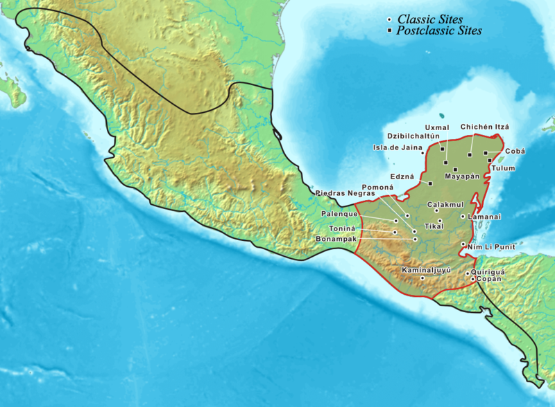
| nıkayên | 20:27, 20 Temuze 2006 |  | 1,074 - 789 (1,010 KB) | Kmusser | Map showing the extent of the Maya civilization, adopted from Mayas.png. |
Gurenayışê dosya
The following pages link to this file:
Gurenayışê dosyaya gılovere
Ena dosya wikiyanê binan de gureniyena.
- af.wikipedia.org sero guriyayış
- ar.wikipedia.org sero guriyayış
- azb.wikipedia.org sero guriyayış
- az.wikipedia.org sero guriyayış
- ba.wikipedia.org sero guriyayış
- be-tarask.wikipedia.org sero guriyayış
- bg.wikipedia.org sero guriyayış
- bo.wikipedia.org sero guriyayış
- br.wikipedia.org sero guriyayış
- ca.wikipedia.org sero guriyayış
- cs.wikipedia.org sero guriyayış
- cy.wikipedia.org sero guriyayış
- da.wikipedia.org sero guriyayış
- el.wikipedia.org sero guriyayış
- en.wikipedia.org sero guriyayış
- Belize
- Tikal
- Maya peoples
- List of conflicts in North America
- User:Kmusser/Images
- List of Maya sites
- Maya civilization
- User talk:Jayantanth/Archive 1
- Pre-Columbian Belize
- History of Belize
- Maya city
- User:Wiki Raja/Gallery
- List of conflicts in Mexico
- Wikipedia:Wikipedia Signpost/2015-08-05/Featured content
- Wikipedia:Wikipedia Signpost/Single/2015-08-05
- Talk:Maya civilization/WTF
- User:SomeGuyWhoRandomlyEdits/List of conflicts in Mexico
- en.wikibooks.org sero guriyayış
- es.wikipedia.org sero guriyayış
- et.wikipedia.org sero guriyayış
- eu.wikipedia.org sero guriyayış
- fa.wikipedia.org sero guriyayış
- fi.wikipedia.org sero guriyayış
- fr.wikipedia.org sero guriyayış
- gl.wikipedia.org sero guriyayış
- hr.wikipedia.org sero guriyayış
Yê na dosya gurenayışê gıloveri tayêna bıvêne.


