
Dosya:Northern Ireland counties + districts.png

Vervênayışê ebadê: 746 × 599 piksel. Agoznayışê bini: 299 × 240 piksel | 598 × 480 piksel | 956 × 768 piksel | 1,275 × 1,024 piksel | 1,672 × 1,343 piksel.
Ebato oricinale (1,672 × 1,343 pikselan, ebatê dosya: 441 KB, MIME tipê cı: image/png)
| Na dosya depoyê Wikimedia Commons de esta u terefê proceyanê binan ra gureniyena. Cêr dê şınasiya dosyay pela mocniyeno. |
Xulasa
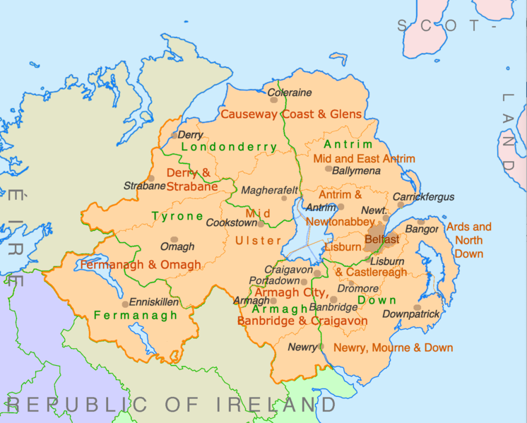
| Şınasnayış | Counties and disticts of Northern Ireland |
| Tarix | |
| Çıme | File:Counties of Ireland.svg & File:United Kingdom Northern Ireland adm location map.svg |
| Nuştekar | Ulamm (werênayış) |
Lisans
Ez, ke ena dosya viraste, bine ena lisansan ser cap kena:

|
Şıma şenê ena dosya kopya kerê, vıla kerê ya zi bıvırnê bınê GNU Free Documentation License, Versiyon 1.2 ya zi versiyonane ke cap biye pê Free Software Foundation; pê nê Invariant Sections, nê Front-Cover Texts u nê Back-Cover Texts. You qısımê kopya bine GNU Free Documentation License estê. |
This file is licensed under the Creative Commons Attribution-Share Alike 4.0 International, 3.0 Unported, 2.5 Generic, 2.0 Generic and 1.0 Generic license.
- Nê weçenegan dê xoseri:
- bare kerdene – qe gure kopya kerdişi, vila kerdişi u şawitişi
- qe reyna mix kerdişi – qe kabul kerdişi gure
- bine enê şarti:
- gıredayış – Lazımo ke şıma icazet bıdê, lisansi rê link, vuriyayış ke biyo belû kerê. Ney şıma usulên ra şenê bıkerê, labelê karkerdış u iştirakê şıma terefê wayirê lisansi ra zey qebulbiyene yew qeyde çıniyo.
- sey yewbini barekerdış – Meqaleyi ke reyna têv dê, tadê ya zi fına inşa bıkerê, iştırakê şıma lazımo ke zey orcinali same or compatible license bın de vıla kerê.
Ti eskena lisanse xo biwecini.
Verêniya dosya
Seba diyayışê viyarteyê dosya ra tarixê ke qısımê tarix/zemani derê inan bıtıkne.
| Tarix/Zeman | Resımo qıckek | Ebadi | Karber | Mışewre | |
|---|---|---|---|---|---|
| nıkayên | 22:28, 9 Temuze 2022 | | 1,672 - 1,343 (441 KB) | Ulamm | some more names |
| 22:31, 8 Temuze 2022 |  | 1,672 - 1,343 (426 KB) | Ulamm | + some places | |
| 12:38, 6 Temuze 2022 |  | 1,672 - 1,343 (383 KB) | Ulamm | + Mid Ulster | |
| 12:03, 6 Temuze 2022 |  | 1,672 - 1,343 (381 KB) | Ulamm | {{Information |Description=Counties and disticts of Northern Ireland |Source=File:Counties of Ireland.svg & File:United Kingdom Northern Ireland adm location map.svg |Date=2022-07-06 |Author=Ulamm (<span class="signature-talk">{{int:Talkpagelinktext}}</span>) |Permission= |other_versions= }} Category:Maps of Northern Ireland Category:Maps by Ulamm == {{int:license-header}} == {{self|GFDL|cc-by-sa-all|migration=redundant}} |
Gurenayışê dosya
There are no pages that link to this file.
Gurenayışê dosyaya gılovere
Ena dosya wikiyanê binan de gureniyena.
- de.wikipedia.org sero guriyayış
- ie.wikipedia.org sero guriyayış
- mt.wikipedia.org sero guriyayış