
Dosya:Saint Jorioz vu de la Cochette.jpg

Vervênayışê ebadê: 800 × 530 piksel. Agoznayışê bini: 320 × 212 piksel | 640 × 424 piksel | 1,024 × 678 piksel | 1,280 × 848 piksel | 3,038 × 2,012 piksel.
Ebato oricinale (3,038 × 2,012 pikselan, ebatê dosya: 3.86 MB, MIME tipê cı: image/jpeg)
| Na dosya depoyê Wikimedia Commons de esta u terefê proceyanê binan ra gureniyena. Cêr dê şınasiya dosyay pela mocniyeno. |
Xulasa
| Şınasnayış |
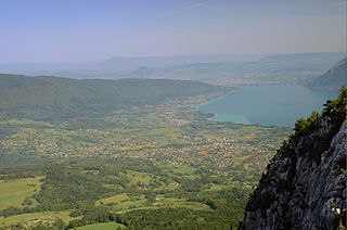
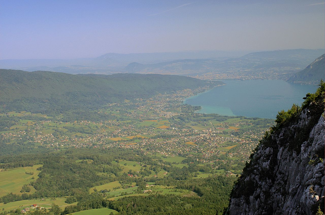
Français : L'agglomération saint-jorienne vue depuis les hauteurs du Roc des Bœufs. On distingue plus loin Sevrier puis Annecy. |
| Tarix | 24 Tebaxe 2005 (original upload date) |
| Çıme | Transferred from fr.wikipedia to Commons. |
| Nuştekar | ²°¹°° at French Wikipediya |
Lisans
| Na karkerdış heta nuskar de ²°¹°° at French Wikipediya ra biya malê şari deye hesereyaya. Dınya heme ca dı ravêrena. Tay dewletan dı no kanuniyey heta mıkum nêbone; o haldı: Ez, ena ²°¹°° qande herhangi yew amaci, be şert, hendı ke legali icab nikeni, şari hemi re ezo mısade dana. |
Qeydê barkerdışê oricinali
The original description page was here. All following user names refer to fr.wikipedia.
- 2005-08-24 20:01 ²°¹°° 3038×2012×8 (1699385 bytes) L'agglomération saint-jorienne vue depuis les hauteurs du Roc des Bœufs. On distingue plus loin Sevrier puis Annecy. {{DomainePublic}}
| Annotations | This image is annotated: View the annotations at Commons |
Verêniya dosya
Seba diyayışê viyarteyê dosya ra tarixê ke qısımê tarix/zemani derê inan bıtıkne.
| Tarix/Zeman | Resımo qıckek | Ebadi | Karber | Mışewre | |
|---|---|---|---|---|---|
| nıkayên | 15:54, 10 Nisane 2013 | | 3,038 - 2,012 (3.86 MB) | Emmanuel.boutet | Enhanced by the french wikigraphistes |
| 06:08, 6 Keşkelun 2007 |  | 3,038 - 2,012 (1.62 MB) | Poulos~commonswiki | {{Information |Description={{fr|L'agglomération saint-jorienne vue depuis les hauteurs du Roc des Bœufs. On distingue plus loin Sevrier puis Annecy.}} |Source=Originally from [http://fr.wikipedia.org f |
Gurenayışê dosya
The following pages link to this file:
Gurenayışê dosyaya gılovere
Ena dosya wikiyanê binan de gureniyena.
- ast.wikipedia.org sero guriyayış
- ca.wikipedia.org sero guriyayış
- ceb.wikipedia.org sero guriyayış
- ce.wikipedia.org sero guriyayış
- de.wikipedia.org sero guriyayış
- el.wikipedia.org sero guriyayış
- en.wikipedia.org sero guriyayış
- es.wikipedia.org sero guriyayış
- eu.wikipedia.org sero guriyayış
- fr.wikipedia.org sero guriyayış
- hu.wikipedia.org sero guriyayış
- it.wikipedia.org sero guriyayış
- la.wikipedia.org sero guriyayış
- lld.wikipedia.org sero guriyayış
- lmo.wikipedia.org sero guriyayış
- ms.wikipedia.org sero guriyayış
- oc.wikipedia.org sero guriyayış
- pl.wikipedia.org sero guriyayış
- ro.wikipedia.org sero guriyayış
- sk.wikipedia.org sero guriyayış
- uk.wikipedia.org sero guriyayış
- ur.wikipedia.org sero guriyayış
- uz.wikipedia.org sero guriyayış
- vec.wikipedia.org sero guriyayış
- vi.wikipedia.org sero guriyayış
- www.wikidata.org sero guriyayış
- zh-min-nan.wikipedia.org sero guriyayış
- zh.wikipedia.org sero guriyayış