
Dosya:Socotra satview.jpg
Vervênayışê ebadê: 800 × 593 piksel. Agoznayışê bini: 320 × 237 piksel | 640 × 474 piksel | 1,024 × 758 piksel | 1,280 × 948 piksel.
Ebato oricinale (1,280 × 948 pikselan, ebatê dosya: 159 KB, MIME tipê cı: image/jpeg)
| Na dosya depoyê Wikimedia Commons de esta u terefê proceyanê binan ra gureniyena. Cêr dê şınasiya dosyay pela mocniyeno. |
Xulasa
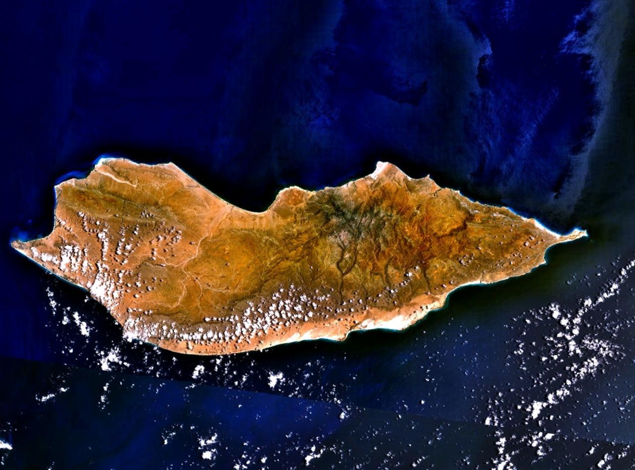
Satellite image over Socotra Island (سُقُطْرَى ; Suquṭra), made using NASA World Wind using Landsat imagery.
Lisans
| This image is in the public domain because it is a screenshot from NASA’s globe software World Wind using a public domain layer, such as Blue Marble, MODIS, Landsat, SRTM, USGS or GLOBE.
|
 |
Qeydê barkerdışê oricinali
All following user names refer to en.wikipedia.
- 2005-07-15 18:16 Finlay McWalter 1280×948×8 (163257 bytes) Satellite image of [[Socotra]], made using [[NASA World Wind]] using [[Landsat]] imagery. {{PD-USGov-NASA}}
| Annotations | This image is annotated: View the annotations at Commons |
Verêniya dosya
Seba diyayışê viyarteyê dosya ra tarixê ke qısımê tarix/zemani derê inan bıtıkne.
| Tarix/Zeman | Resımo qıckek | Ebadi | Karber | Mışewre | |
|---|---|---|---|---|---|
| nıkayên | 16:16, 7 Çele 2007 | | 1,280 - 948 (159 KB) | EskoG-67 | {{Information |Description= Satellite image over Socotra island |Source=NASA Landsat |Date= 7.1.2007 |Author= |Permission= |other_versions= }} |
Gurenayışê dosya
The following pages link to this file:
Gurenayışê dosyaya gılovere
Ena dosya wikiyanê binan de gureniyena.
- af.wikipedia.org sero guriyayış
- ar.wikipedia.org sero guriyayış
- ast.wikipedia.org sero guriyayış
- az.wikipedia.org sero guriyayış
- be-tarask.wikipedia.org sero guriyayış
- be.wikipedia.org sero guriyayış
- bg.wikipedia.org sero guriyayış
- bn.wikipedia.org sero guriyayış
- ca.wikipedia.org sero guriyayış
- cs.wikipedia.org sero guriyayış
- cv.wikipedia.org sero guriyayış
- cy.wikipedia.org sero guriyayış
- da.wikipedia.org sero guriyayış
- de.wikipedia.org sero guriyayış
- el.wikipedia.org sero guriyayış
- en.wikipedia.org sero guriyayış
- eo.wikipedia.org sero guriyayış
- es.wikipedia.org sero guriyayış
- et.wikipedia.org sero guriyayış
- eu.wikipedia.org sero guriyayış
- fa.wikipedia.org sero guriyayış
- fi.wikipedia.org sero guriyayış
- fr.wikipedia.org sero guriyayış
Yê na dosya gurenayışê gıloveri tayêna bıvêne.