
Dosya:ISS006-E-38029 - View of the Lesser Antilles.jpg

Vervênayışê ebadê: 800 × 545 piksel. Agoznayışê bini: 320 × 218 piksel | 640 × 436 piksel | 1,024 × 697 piksel | 1,280 × 871 piksel | 2,560 × 1,743 piksel | 3,032 × 2,064 piksel.
Ebato oricinale (3,032 × 2,064 pikselan, ebatê dosya: 945 KB, MIME tipê cı: image/jpeg)
| Na dosya depoyê Wikimedia Commons de esta u terefê proceyanê binan ra gureniyena. Cêr dê şınasiya dosyay pela mocniyeno. |
Xulasa
| Şınasnayış |
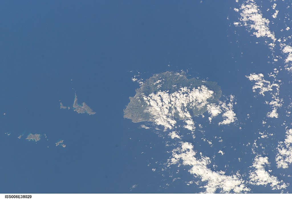
English: View of the Lesser Antilles taken during ISS Expedition 6. |
| Tarix | |
| Çıme | JSC Gateway to Astronaut Photography of Earth |
| Nuştekar | Earth Science and Remote Sensing Unit, Lyndon B. Johnson Space Center |
| Mission | ISS006 |
| Roll | E |
| Frame | 38029 |
| Geographic area | the Lesser Antilles |
| Features | SAINT VINCENT AND GRENADINES |
| Cloud percentage | 25% |
| Altitude | 213 nautical miles (394 km) |
| Look angle | 45 |
| Look direction | S |
| Sun Azimuth | 109° |
| Sun Elevation | 40° |
| Camera | Kodak DCS760c Electronic Still Camera |
| Focal length | 180 mm |
| Camera location | | View this and other nearby images on: OpenStreetMap |
|---|
| Object location | | View this and other nearby images on: OpenStreetMap |
|---|
This image or video was catalogued by Johnson Space Center of the United States National Aeronautics and Space Administration (NASA) under Photo ID: ISS006-E-38029. This tag does not indicate the copyright status of the attached work. A normal copyright tag is still required. See Commons:Licensing. Other languages:
|
Lisans
| This file is in the public domain in the United States because it was solely created by NASA. NASA copyright policy states that "NASA material is not protected by copyright unless noted". (See Template:PD-USGov, NASA copyright policy page or JPL Image Use Policy.) | ||
 |
Warnings:
|
Verêniya dosya
Seba diyayışê viyarteyê dosya ra tarixê ke qısımê tarix/zemani derê inan bıtıkne.
| Tarix/Zeman | Resımo qıckek | Ebadi | Karber | Mışewre | |
|---|---|---|---|---|---|
| nıkayên | 23:26, 9 Tebaxe 2022 | | 3,032 - 2,064 (945 KB) | AskeBot |
Gurenayışê dosya
The following pages link to this file:
Gurenayışê dosyaya gılovere
Ena dosya wikiyanê binan de gureniyena.
- arz.wikipedia.org sero guriyayış
- ast.wikipedia.org sero guriyayış
- ca.wikipedia.org sero guriyayış
- cy.wikipedia.org sero guriyayış
- dag.wikipedia.org sero guriyayış
- de.wikivoyage.org sero guriyayış
- eo.wikipedia.org sero guriyayış
- fr.wikivoyage.org sero guriyayış
- ga.wikipedia.org sero guriyayış
- gl.wikipedia.org sero guriyayış
- kab.wikipedia.org sero guriyayış
- pap.wikipedia.org sero guriyayış
- tg.wikipedia.org sero guriyayış
- vec.wikipedia.org sero guriyayış
- www.wikidata.org sero guriyayış